
Photographs by the author, 2023. [You may use these images without prior permission for any scholarly or educational purpose as long as you (1) credit the photographer and (2) link your document to this URL in a web project or cite it in a print one. Click on all the images to enlarge them.]
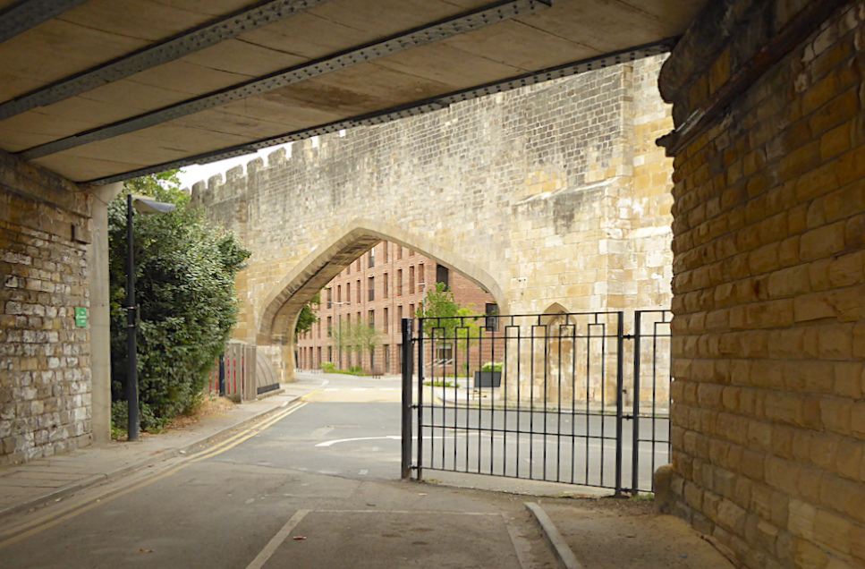
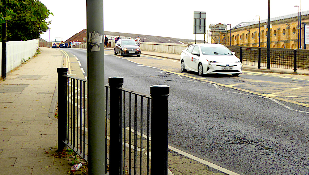
First arch, seen from beneath the later Queen Street Bridge, and looking ahead towards York's first (184l) railway terminus.
In the nineteenth century, the city was beginning to respect its old walls, and instead of sweeping them away under the name of progress, gave permission for the five arches which were eventually cut between the western angle of the medieval walls and its end beside the river, to serve the railway. The first arch, shown above, was for the 1841 passenger station.
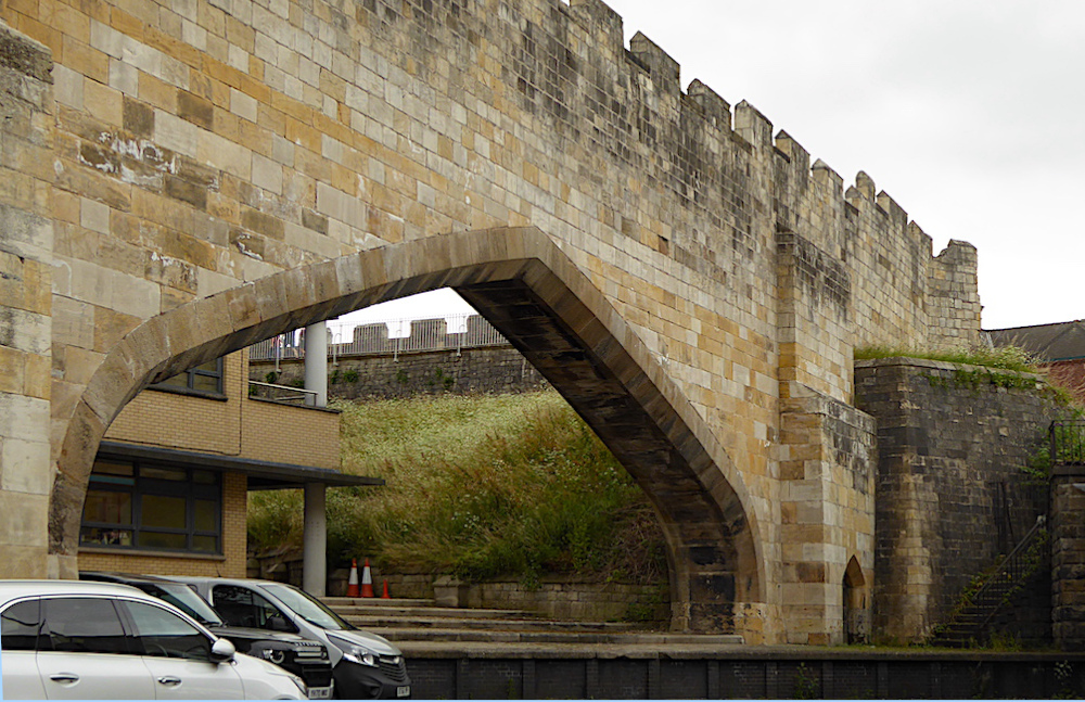
Second arch, with east face of Queen Street Bridge. This was cut to serve a Goods depot situated to the south of the station's passenger services.
The second arch, cut in 1845 to the south of the first one, was for the goods depot. With the modern redevelopment on the land around George Townsend Andrews’ railway station, it is now possible to walk through the arch where the trains first ran in 1841; the span of the arch allowed for two tracks.
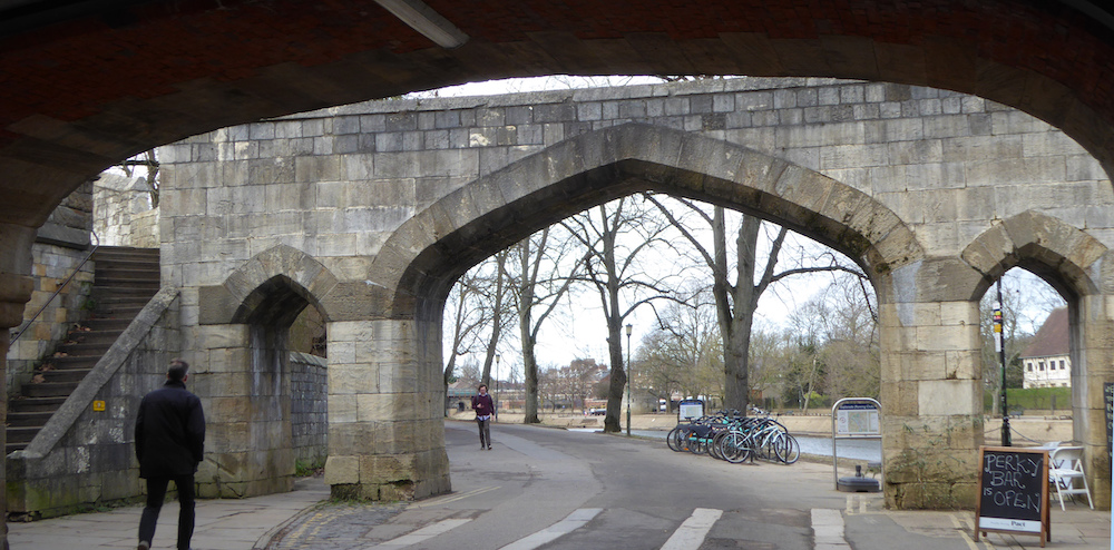
Andrews's arches where the medieval wall ends at the river, at Barker Tower (just off right), seen from below Lendal Bridge.
The plain ‘Tudor’ arch was used again by Andrews in making road access to a coal depot for the Great North of England Railway Company near Barker Tower by the river in the early 1840s (Fawcett 51), while the later Station Road to the 1877 station has two further arches for road traffic in much the same form; thanks to all these arches within 500 yards (450m), the footway round the walls from Barker Tower towards Micklegate was maintained.
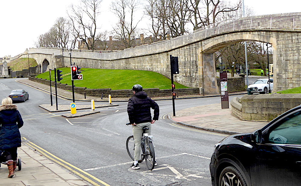

Arches under the city walls made to give access from Lendal Bridge to the 1877 station.
At first, the railway using the terminus built by George Hudson and Andrews did not affect road traffic much: Queen Street was a cul-de-sac from Micklegate Bar and Blossom Street, and a level crossing was used by the occasional local traffic going through largely open ground towards the river. However, with the new station in 1877, road traffic increased and at the same time, rail traffic into the old terminus declined: it was decided to replace the level-crossing by joining Queen Street to the new Station Road by a road-bridge.
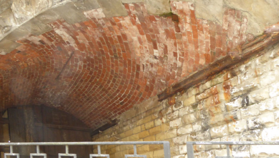
Left: Queen Street Bridge in use. Right: Some of the brickwork supporting the bridge.
The bridge had to be widened and strengthened later so that much of the original construction is concealed under concrete, but in some places the curving, diagonal, brickwork of the old bridge roofs can be seen to resemble that in tunnels on railway lines more widely. The tracks into the old station were still being used in the 1960s. At the time of writing in 2023, it is proposed to demolish the bridge and bring the road to ground level.
Bibliography
Fawcett, Bill. George Townsend Andrews of York: “The Railway Architect." . York: YAYAS and North Eastern Railway Association, 2011.
Pevsner, Nikolaus, and David Neave. Yorkshire: York and the East Riding. New Haven and London: Yale University Press, 2002.
Created 17 February 2023