
SOUDAN, or Súdán (Bilád es-Súdán, “Country of the Blacks”), a term applied by mediaeval Aral geographers to the region of Africa south of the Sahara mainly inhabited by peoples of Negro blood hence corresponding to the expressions Nigritia, Negroland, at one time current among European writers.
It lies mainly between 5° and 18° North latitude, consequently entirely within the tropics, and in its widest sense stretches right across the continent from Cape Verde on the Atlantic to Massowah on the Red Sea. But the term is more usually restricted to the region bounded North by the Sahara, on the South by Upper Guinea and the lands draining to the Congo basin, West and East by Senegambia and the Abyssinian highlands respectively. Within these limits it has an extreme length of about 3000 miles between the Senegal river and Abyssinia, extending southwards at some points 660 miles, with a total area of perhaps 2,000,000 square miles, and a population approximately estimated at from 80 to 90 millions. From the arid and sandy northern wastes to the well-watered and arable Soudanese lands the transition is effected by an intermediate zone of level grassy steppes, partly overgrowi with mimosas and acacias, with a mean breadth of about 60 miles, between 17° and 18° North latitude, but towards the centre reaching as far south as 15° North. Excluding this somewhat uniform transitional zone, the Soudan, properly so called, may be described as a moderately elevated region, diversified with extensive open or rolling plains, level plateaus, and even true highlands, especially in the southwest.
It constitutes three distinct hydrographic systems, corresponding to the three main physical divisions of Western Souaan draining througn the Niger southwards to the Atlantic; Central Soudan, draining to the great central depression and landlocked basin of Lake Tchad; an Eastern (Egyptian) Soudan, draining through the Nile northwards to the Mediterranean. Between these systems the chief waterpartings are —(1) the Marral Mountains of Dar-Fur whence now the Bahr es-Sálámd west to the Shari, and numerous intermittent wadies east to the Nile; (2) the Monbuttu uplands (Moun Baginze) separating the western headstreams of the White Nile from the Welle (Bahr Kuta), which, according to the latest information, flows, not to the Shari as Schweinfurth supposed, but to the Congo through the Mbangi; (3) the so-called “Kong” Mountains, dividing the Niger basin from the Volti and other streams flowing in independent channel: south to the Gulf of Guinea. The Adamawa high south to the Gulf of Guinea. The Atiamawa highlands, culminating in Mount Alantika (9000 to 10,000 feet), do not form a divide, as was supposed, between the Binue (the main eastern tributary of the Niger) and the Logon and other streams flowing east to the Shari (the great southern affluent of Lake Tchad). Flegel, who has recently explored the upper course of the Binue, found that it sweeps right round the east foot of Mount Alantika, and is even navigable round this bend and some way southwards.
On the other hand, the central hydrographic system of Lake Tchad has been greatly reduced in size since Lupton, Grenfell, and other recent explorers have made it evident that the Bahr-Kuta (Welle) flows not to the Shari but to the Congo basin. The Shari basin, which is now known not to reach farther south than about 6° North latitude, may even be almost considered, physically as well as politically, as subsidiary to the Niger hydrographic system, for there are indications that the Logon once flowed into the Binue by the Mayo-Kebbi. The Mayo-Kebbi is a long flat trough or valley in 9˚ 30' North latitude, with a level swamp at the bottom receiving as a backwater the overflow of the Logon, and also draining through the Binue to the Niger. By canalizing the Mayo-Kebbi the Binue and Shari basins might be permanently connected, in which case the Niger system would afford a navigable waterway from the Gulf of Guinea to the southernmost limits of Bag-hirrai.
From the Kong highlands, some of whose peaks appear to attain elevations of 6000 to 7090 feet, Western Soudan falls gradually towards the north and northeast down to the Great Desert where the city of Timbuktu still maintains an altitude of 770 feet above sea-level (Lenz). Southeast of the Niger the land rises in terraces of 1000 and even 3000 feet, above which isolated crests range from 5000 to 9000 feet. This little known western highland region, comprised between the Binue and the lower Niger, and extending from Adamawa to the Cameroons on the Bight of Biafira, corresponds with the eastern highland region of Abyssinia, lying between the Blue Nile and the Ta-gazze and dominating the Red Sea.
North of Adamawa the land falls rapidly down to the vast depression of Central Soudan, whose lowest part is flooded with the waters of Lake Tchad (Chad or Tsad), the largest area of inland drainage, next to the Aral-Caspian basin, in the eastern hemisphere. This freshwater lacustrine depression, usually 10,000 square miles in extent, expands to 40,000 and even 50,000 square miles when swollen by the flood-waters of its great feeders,— the Logon-Shari from the south and the Komadugu from the west. From the Tchad depression, which is still 1150 feet above the sea, the ground rises again eastwards in the direction of Wadai and Dar-Fur, to heights of 3000 feet and upwards, culminating in the volcanic Jebel Marrah (6000 feet), which forms the natural eastern limit of Central Soudan, and the great divide between the Tchad and Nile basins.
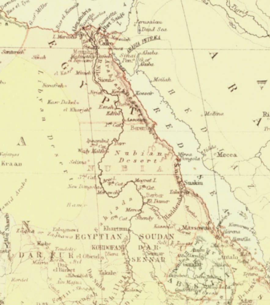
But politically the line between Central and Eastern Soudan is usually drawn more to the west along the conventional frontiers of Wadai and Dar-Fur, the latter province, although never completely reduced, being claimed as part of Egyptian Soudan. This region constitutes two distinct physical divisions, —the first comprising the provinces of Dar-Fur and Kordofan, bounded east by tne White Nile and south by the Bahr el-Arab, a tableland in which the steppe formation predominates, while the second is skirted east by the Bahr el-Jebel and stretches from the Bahr el-Arab southwards to the Monbuttu uplands, a vast plain watered bv the numerous southwestern headstreams of the White Nile. This plain rises gradually towards the south and southwest to the highlands, which appear to culminate in Mount Baginze, and which form the water-parting between the Nile and Congo Basins. Included in Eastern Soudan is also the extensive plain of Senaar, stretching from the Nile eastwards to the Abyssinian uplands, and rising southwards to the Fazokl and" Berta highlands. [22.290-91]
Related material
Bibliography
“Soudan.” The Encylopædia Britanica or Dictionary of Arts, Sciences, and General Literature. 9th ed. Philadelphia: Maxwell Sommervile: 1894. 25 vols. Hathi Trust Digital Library online version of a copy in the University of New York Public Library. Web. 20 August 2020.
Last modified 20 August 2020