
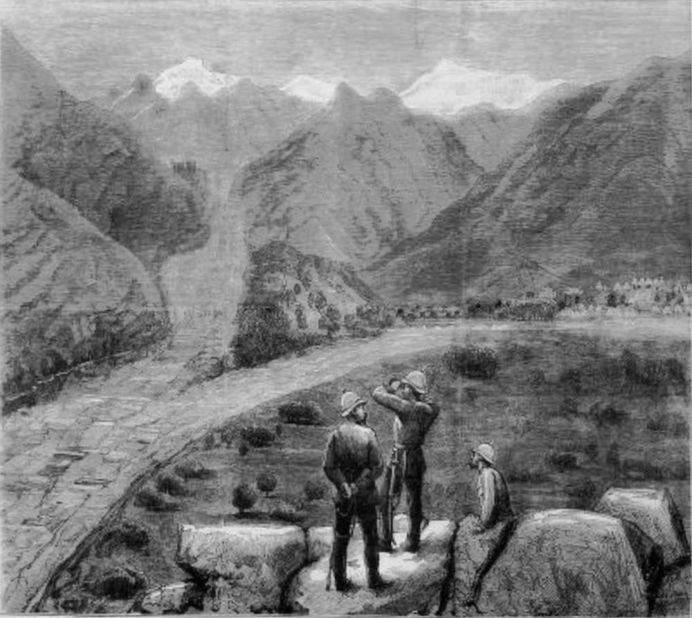
The Afghan War‚ Village of Thull and Encampment of the Kuran Field Force. The Graphic (21 December 1878): 620. Three captions in fine print above the picture and four below explain the details in the landscape. The leftmost caption above the picture explains that the dark rectangles in the left distance represent the “Fortress of Kapyunga,” and the mountain peak that appears at the top of the landscape slightly to the right is “Sufeid Koh (White Mountain);” “Kakamokh Hill” is the name of the hill at extreme right. Click on image to enlarge it. Below the image the leftmost area we see the “River Koram” and “Sangreba Nudee” to the right, possibly indicating the road. “Thull” appears at the enter and the tents of the British army encampment at far right.
Related Material
You may use these images without prior permission for any scholarly or educational purpose as long as you (1) credit the Internet Archive and New York Public Library and (2) link your document to this URL in a web document or cite the Victorian Web in a print one. — George P. Landow]
Bibliography
“The Afghan War‚ Village of Thull and Encampment of the Kuran Field Force.” The Graphic (21 December 1878): 620.. Internet Archive online version of a copy in the New York Public Library. Web. 18 August 2018.
Last modified 18 August 2018